Saturday, May 20, 2017

May 17th Fort Griffin State Historic Site

Fort Griffin Entry Gate, originally built by the CCC 1939-41.
Current sign by Texas Historic Commission, 2008
With reluctance I left Albany, Texas having fallen in love with this small, historic town. The architecture, history and people of Albany are all wonderful, but I had other things to see and places to go, so I headed north on 283 towards Fort Griffin. When I arrived at a nicely designed modern building mine was the only vehicle in the parking lot. I was warmly greeted by Jane Lenoir and when I told her about my family history search she instantly turned to her computer and started bringing up news articles on the Portal of Texas History website that featured my first cousin 3x removed D.G. “Mule” Stover. Jane had heard of Mule – the third person to tell me that – I guess he was memorable.
"Photograph of a hog hanging from a winch with Mule Stover
 leaning against it. Watt Matthews can be partially seen
 behind Stover. Richard King stands to the right near a barrel."
 Thanks to the Matthews Family and Lambshead Ranch
 from the Portal to Texas History Website
Jane Lenoir at her computer and a Texas Longhorn on her wall

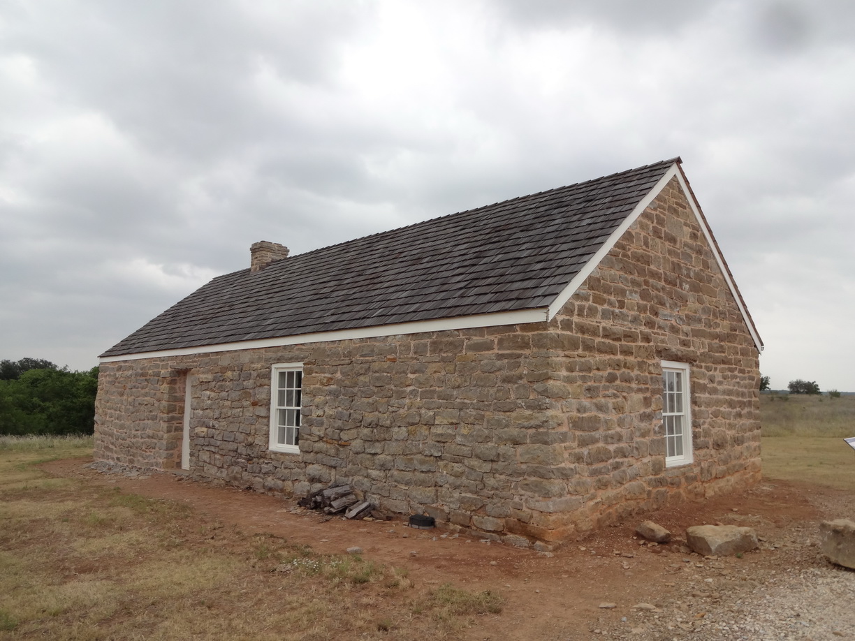
Jane then proceeded to explain everything that I needed to see while at the site. She sketched everything out on a map and I dutifully followed her instructions. I’m glad I did because I saw things I would have missed otherwise. Fort Griffin was another recipient of the CCC crew’s work from 1939-41. They built the park’s entry sign, roads and several other park structures. Later the park reconstructed several of the historic wooden buildings for interpretation. Portions of a few of the original stone structures remain. 
Foundation of a 1st Sergeant's residence

Fort Griffin was a military site from 1867 to May 31, 1881. It was established to protect settlers from attack by the Comanches and Kiowas tribes. The site of the fort is on top of Government Hill and near the Clearfork of the Brazos River which is where “Mule” and his parents owned a ranch. Since 1948 the park has been the official home of the State of Texas Longhorn herd. Texas Longhorn cattle are beautiful animals of which Texans are rightly proud.

After leaving the Fort I drove into the Fort Griffin Campground and found a beautiful facility – one of the nicest I’ve ever seen. The campsites were generously large and nicely shaded by trees.  I was sorry I wasn’t ready to stop for the day – it would have been a nice place to stay.
Fort Griffin bakery

Interior of the bakery

Bakery ovens
One of the exhibits included this photo and explanation that prior to 1884 when
the railroad came to this part of Texas, this was the most efficient way to travel
with a flatbed wagon pulled by oxen, horses or mules. Since my great grandfather
arrived in 1879 I imagine this is how he arrived from Virginia.

Part of the herd on the 502 acre park site

Original location of the Fort Griffin military cemetery

Interior of the messhall
Ruin of the Administration building

Informal display of artifacts found at the fort

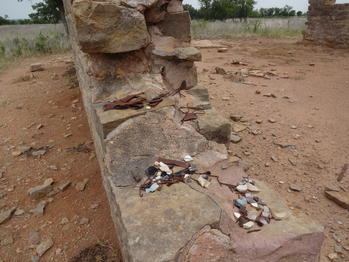
Detail showing wall constructgion

Tuesday, May 16, 2017

May 16th - Albany, Texas

Shackelford County Courthouse in Albany, Texas, built 1883
I’ve heard that people in Texas are friendly. Today I experienced the truth to that statement, and I would add they are helpful and generous. This morning I drove from Snyder, Texas to Albany, Texas which is in Shackelford County and I started the genealogy part of this trip. My great grandfather James William Pattillo left Mecklenburg, Virginia after the Civil War and migrated to Tarrant County, Texas. The earliest record I have for his being in the county is his marriage to Carrie Brooks Stover on 5 April 1879. On the 1880 Tarrant County census James was identified as a cattle dealer living in Handley just west of Fort Worth. By 1887 James and Carrie were living in Los Angeles, California but Carrie’s brother David Gaines Stover remained in Texas.
Entrance to the Albany Cemetery
There are footprints of this branch of my family in three counties all west of Fort Worth – Tarrant, Stephens and Shackelford. I started in Shackelford where I knew Carrie’s brother, his wife and two of his sons are buried in the Albany Cemetery. Saundra Nobles had surveyed the cemetery and uploaded all her data and photos onto the FindAGrave site. The section, block and lot numbers were all listed on the site, so I figured finding them would be easy. It’s a large cemetery with very clearly labelled street names but I didn’t see any section, block or lot numbers. I was stumped.
Albany Visitor Center interior that was originally the
train station

Well, I noticed a pickup truck close by so I approached and asked the occupant if she might possibly be able to decipher the layout and help me find my Stover relatives. She was very friendly and thought about my question but did not know the name or the plot. She suggested I visit the Albany library and ask there. So, I headed back into town – a short distance – and stopped at the visitor center where another friendly and helpful woman told me where to find the library – a small, red brick building next to the bank.

In the library I was greeted by librarian Myra Hise who did not have a plot plan of the cemetery but she did know Saundra Nobles and offered Saundra’s phone number. So, I telephoned Ms. Nobles who was home and said, “wait 15 minutes and I’ll take you to the plot”. I continued to chat with Myra until Saundra arrived and showed both of us how to use the GPS coordinates she’d entered on the FindAGrave site to locate the Stover plot. Myra shared a beautiful quilt she was working on for her grandson and Saundra and I were off. She walked me to the plot, I thanked her and we said our goodbyes. I could not quite believe my good luck. I hope this is an omen of how this trip is going to continue.
Gazebo and old pepper tree on the courthouse grounds

After sweeping off each headstone and taking photos I headed back into town. While in the library I had asked Myra how I might find out where David Gaines Stover’s ranch had been. She suggested two things. First, ask Steve Waller in the bank next door if he knows where the Stover Ranch had been. So, my next stop was the bank where I met a very friendly banker who knew a great deal about Albany’s history and though he gave it considerable thought was not able to recollect where the Stover Ranch had been. Steve gave me a recommendation for where to have dinner, suggested where I could stay in town in an RV park. He also suggested I go see the county archivist, Molly Sauder.
This wonderful Sinclair service station has been fully restored including the
original sign, pump and gas truck. It is across the street from the courthouse.

Molly was quite young, friendly and efficient. She didn’t recall the Stover name but did find a small file with about 15 Stover-Tipton documents. Another of my great grandmother’s siblings, a sister Sarah, had also remained in Texas and married Winfield Scott Tipton. Molly allowed me to scan each of the documents – some were things I’d found before but a few were new finds. These archives are located in a new addition to what had been the original county jail. The jail was built in 1877 but was abandoned in 1929 when a new facility was built nearby. By 1940 some in the community saw it as an “eyesore” and wanted to tear it down. Instead it was purchased by Robert Nail and passed on to his nephew Reilly Nail in 1968. Finally in 1980 the jail was renovated and expanded and converted into the Old JailArt Center – a beautiful facility that now houses 2400 works of art and is accredited by the American Alliance of Museums.
Saw this map in the Dawson County Courthouse. In the top,
center are Shackelford, Stephens and Tarrant Counties
 I inquired about how I might find records that explained where David G. “Bud” Stover’s ranch had been and Molly suggested I try the City Clerk’s office in the courthouse, but as I was lingering and looking at the artifacts they have in a small museum, I could not help but overhear two sisters talking about some of the exhibits. It turns out they own several items in the collection. It was clear they were locals so on a chance I asked, “Does the name Stover mean anything to you?” They thought just a moment and said, “We remember “Mule” Stover. He and a group of guys would sit there on a big bench across from the soda fountain and talk. They described him as a very large man that was balding. Mule was a good friend of their father Carrol Putnam who served in WWI. They didn’t think their mother liked Mule much because he was a bit of a loud mouth, but they liked Mule as did their father.” Mule was the nickname for David Gaines Stover Jr. (1903-1968) who went by Gaines Stover. In his obituary a friend noted, “He had a genius for helping people”.

As I said my goodbye Julia Putnam told me I should visit the Abstract Office and talk with Kathy in the City Clerk’s office. Both were closed by the time I arrived so that is tomorrow’s agenda plus Historic Fort Griffin. 

Everyone I encountered today was warm, friendly, helpful and remarkably generous. Thank you Albany, Texas – a great town.
This is David Gaines "Mule" Stover Jr.

Nancy Williams Stover, D.G. Stover Sr's wife

Eugene was David Gaines "Bud" Stover's son
Joanna Stover Ayres is Bud's daughter

Horace was Joanna's husband
 
This is David Gaines Stover, my great granduncle

Sunday, May 14, 2017

May 14th - White Sands National Monument

Me at the Visitor Center of White Sands National Monument
Yesterday evening I had a difficult time deciding which way to go today. There were three places of interest to the south but that was out of my way. White Sands National Monument looked beautiful but I feared it would be unbearably hot. I finally decided to head north towards Almagordo, New Mexico and White Sands. That was the right decision – it’s a stunning place visually, and since I was there in the morning the temperature was reasonable.

The monument was created in 1933. The visitor center was another job-creation project during the great depression. It was built in 1936 by the WPA (Works Progress Administration) in the Pueblo Revival style. Today the collection of buildings is a designated Historic District.
Visitor Center - A designated Historic District

Interior of the Visitor Center 
The dunes consist of gypsum sand and were created over thousands of years by wind and erosion. They are constantly changing – one of the interpretive signs said they can be 45 feet high and “travel up to 38 feet in a year”. Hikers are encouraged to take along a compass because the wind can quickly erase your footsteps and one can get disoriented.


There were very few things in bloom

About halfway into the park there is a very nice boardwalk that provides easy access through the dunes and good views of the vegetation, dunes and a few lizards. Continuing on, the asphalt road was thin and covered with sand. Driving over the washboard surface was something else in the motorhome – the racket from the rattling was intense.
This is the 1/4 mile boardwalk that crosses the dunes

This species of lizard evolved from brown to white as
an adaption to its environment

This blue head and tailed lizard was busy
excavating an underground escape
After leaving the monument I headed east on Highway 82. The portion of the road that passes through the Lincoln National Forest is a designated scenic highway. After days of driving through desert the lush water-loving willow and poplar trees was a relief to my senses. As the road climbed higher the forest transitioned to conifers – similar to our Sierra Range. It was glorious. 

As I descended the mountain the horizon was filled with poufy clouds. It felt good driving through these varied landscapes knowing that my mother would wholly approve. She is the one who planned all our family vacations, who instilled a love of the outdoors and camping in me, and she is the person who gave me the gift of self-confidence by always supporting whatever I tried in life. I would not have had the courage to make this trip alone without my mother’s support which I feel even now three years after her death. Happy Mother’s Day Mom.
The motorhome looks rather space age in this setting

You can rent a sled at the visitor center to slide down the dunes

Some creature made this interesting sand circles

Friday, May 12, 2017

May 12th - Tucson to Chiricahua National Monument

Leaving Liz's in Tucson in my new RV shirt
I left Liz’s home in Tucson about 10:00 this morning and headed east on Highway 10. I drove to Wilcox, Arizona and from there turned south on 186, a scenic road, to Chiricahua National Monument. The monument is a small area within the Coronado National Forest in southeast Arizona.

On the way to Wilcox I made on stop at Council Rock where there is a distinct outcrop of large, rounded boulders and piles of rocks. A commemorative marker at the rest stop said Council Rock was where Cochise and the Chiricahua Apache ratified a peace treaty in 1872. An interpretive sign explained how Cochise and Geronimo used the surrounding rocks as fortresses. Cochise successfully evaded capture for 12 years.

The Chiricahua National Monument was established in 1924. Near the visitor center there is a monument to the Civilian Conservation Corp (CCC) that built the buildings and structures in the park. This piqued my interest because three years ago I suggested that the theme for that year’s HALS (Historic American Landscapes Survey) Challenge should be to document projects built by the CCC during Roosevelt’s New Deal program – 1933-1942. The idea proved to be very popular. As I recall the National Park Service received the highest number of HALS submissions that year. 
Chiricahua Natl Monumnet Visitor Center built by the CCC

Park signs by the CCC

6-sided Exhibit Building at Massai Point built by the CCC

I did two short hikes while in the park. First to Massai Point and then a one mile hike to Echo Canyon Grotto. Each offered views of varied rock formations – pinnacles, totems, columns and unnerving stacked boulders. It was a pretty rugged but safe trail and hot.
If you blow this up you can see Cochise's head - he is
lying in the middle of the hill

One of the many unnerving balanced rocks in the park

This spot is known as the grotto even though
there is no water anywhere nearby

A large collection of stacked rocks


Tonight I am back in Wilcox with the air conditioning on high waiting for it to cool down outside. Tomorrow I’m headed for New Mexico.
Council Rock Rest stop on Highway 10
Geronimo and his warriors from the interpretive sign

View from Massai Point

This illustrates the entire 12,025 acre park.
The monument is the square gray area near
the top